Visions of Government: A Nineteenth-Century Road Trip
 In terms of the spectacle of modern engineering, the most impressive route that a visitor to London in 1830 could take were the parliamentary routes to Scotland and Ireland.
 Setting out from the stagecoach yard before the gleaming marble temple front of the General Post Office in London, with the dome of St. Paul’s looming overhead, the stage coach would rattle over new-paved streets of smooth flagstones, only recently carved, through parliamentary order, from the former slums of St. Martins-le-Grand. Where thieves and prostitutes had hidden a decade ago, Aldersgate Street and Goswell Road, lined with glassy shops selling trunks, books, and food for the traveler, drew the stagecoach north, past the Angel Inn on Islington’s High Street. Wide highways continued north, avoiding the imposing northern hills that had killed horses twenty years before, and cutting through the new monumental canyonway bridged John Nash’s soaring Highgate Archway. From there, the coach passed into the wide, smooth toll roads of St. Alban’s, bright with granite gravel. Within memory these turnpikes had been full of zig-zags and potholes, but in the last ten years they had come under parliamentary control, and now they were straight, smooth, and regular, with neat fences on either side and generous footpaths for pedestrians all the way. North of London, one could continue north towards Edinburgh or northwest towards Wales and the steamboats to Dublin.
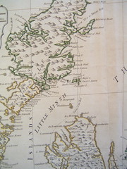
The trip to Scotland was well paved, from London north all the way to the Isle of Skye. Turnpikes under parliamentary control took the passenger as far north as Birmingham, or less far if he went the eastern route. But those turnpikes were slated for parliamentary control, and soon, some hoped, the same straight highways would shoot clear north to York and then to Edinburgh. In the Highlands, where the rocky hillsides housed only a few poor shepherds and crofters, travelers found signs of advanced industry. 1117 bridges connected straight, wide roads, as far out as the islands, bringing them all into contact with the ports and capital, at a cost of £1,150,000, or roughly the equivalent of all tax revenue collected in Ireland in one year. These parliamentary roads counted for about one quarter of all roads in Scotland. Wales and Ireland too were well connected. Iron and stone bridges of arches of spans as wide as 150 feet bridged the Dornoch Frith and River Spey, these marvels of modern engineering contrasted against primeval territory “where the rapid river cleaves for itself a passage through the solid rock.” Parliamentary roads opened the Highlands to “shoals of travellers” every summer, who marveled at the remote vistas now made accessible to traders and tourists: “rugged heights, brawling torrents, and fearful mountain-passes, undreamt of out of the Highlands themselves half a century ago.” Now these natural wonders were “exposed to the gaze of the wearers of pink parasols, and transferred to their scrap-books.”
The road to Holyhead through Wales, “the best in the kingdom,” was even more marvelous from the perspective of engineering. Flat roads, “as even as a ‘parquet’,” had been made by “cutting down large hills and filling up deep valleys” navigated past “floods of foam” in the “dark waters below,” past “towering cliffs,” “grotesque groups of upright rocks,” and “somber woods, …here and there concealing the torrent.” The line included cutting into sheer rock, “in some parts 30 feet in height, with high breast and retaining walls, stone parapets laid in lime-mortar…. So that this formerly frightful precipice is now a safe trotting road.” Tall embankments lifted the road above mountain cataracts and tempestuous coastal sands. Thomas Telford’s soaring Menai Straits Bridge, which stretched 1717 feet to the island of Anglesey, where Parliament had constructed a new harbour. Seven stone arches bridged the “deep rapid tidestream” below, carrying the roadway 53 feet above road level, and across a roadway carried by iron rods hanging from four suspended chains 1714 feet long, each of which weighed 121 tons. A visiting Scot observed, “In standing upon the bridge, suspended by massive chains, and beholding a stately vessel passing, at a depth of 100 feet below, it is impossible not to feel impressed with the magnitude and boldness of the attempt.” Another tourist was struck how “a coach going over appeared not larger than a child’s toy, and that foot passengers upon it looked like pigmies, the vastness of it proportions” Another visitor immediately felt a surge of “national pride,” to such a transporting degree that “this stupendous bridge instantly reminded me of St. Peter’s church at Rome.”
These smooth pavements, soaring bridges, and steep embankments were built by parliamentary engineers, maintained by parliamentary surveyors, and financed through local divisions under the control of parliamentary commissioners. An immense enterprise, administered by hundreds of men commanding millions of pounds deployed over thousands of miles, the parliamentary highways were the physical face of a new form of government.


